
Thirsty? You will be. The Timberline Trail around Mount Hood is a Pacific Northwest classic—but unless you want to haul a gallon of water up 20,000 feet of elevation gain, you’d better know where to fill up (and where to definitely not).
This guide lays out almost every known water source on the Timberline Trail using a custom map, color-coded by type and flow. It’s designed to help you plan smarter, carry less, and keep your filter (and intestines) in working order.
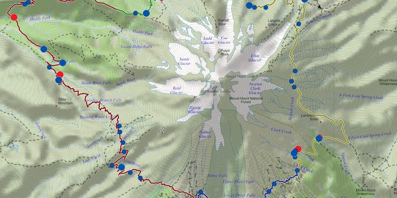
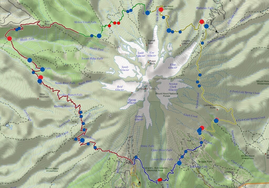
The Map: How to Use It
The map above shows water sources along the Timberline Trail:
- Dot size = flow size. Bigger dot, bigger creek.
- Blue dots = good to go. These are standard snowmelt or spring-fed streams, fine for filtering.
- Red dots = glacial runoff. Do not filter these unless you’re in the market for a clogged filter.
Want to take this info on the trail? You can download the image or import the GPX overlay here.
Why You Shouldn’t Filter Glacial Streams
Glacial streams look epic—icy, milky-white, dramatic. But that color comes from rock flour, a fine silt created by glaciers grinding rock into powder. Your average backpacking filter (Sawyer, BeFree, QuickDraw, etc.) was not designed to handle that.
Filtering glacial water will clog your filter in one sitting. If you absolutely must drink from one (and I don’t recommend it), let the water settle in a container overnight, then decant the clear stuff from the top. Still, much better to avoid these altogether.
Segment-by-Segment Water Guide
Here’s the breakdown clockwise from Timberline Lodge. Note: distances approximate.
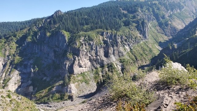
📍 Timberline Lodge to Ramona Falls (0–12 mi)
- Zigzag River – Large, reliable, and although it runs from a glacier, its generally running clear at the crossing
- Small creeks along Paradise Park side trails (blue) are good choices if flowing.
- Sandy River – avoid the Sandy directly, but there are some tributaries that are fine. One is just before the Sandy River. Rushing Water Creek. There are also some fine camp sites along the creek as well.
- Ramona Creek – Blue. One of the best spots on trail. Easy to scoop.
📍 Ramona Falls to McNeil Point (12–18 mi)
- Multiple small streams cross the trail. Most are blue.
- Muddy Fork – Big, glacial (red). Avoid for filtering.
- McGee Creek – Beautiful, blue, and reliable.
There are two options on. this stretch, the official Timberline Trail or the PCT Reroute. The Muddy River crosses both routes and should be avoided. Water sources from Ramona to Top Spur can be a little limited by the end of the season.
📍 Eden Park to Elk Cove (18–26 mi)
- Ladd Creek – avoid another set of glacial creeks
- Compass Creek – Blue. Great alternative.
- Elk Cove has a great water source, as well as great camping
- Small streams near Cairn Basin: good late-summer fill spots.
📍 Elk Cove to Newton Creek (26–34 mi)
- Coe Branch – Glacial and violent (red). Do not filter.
- Eliot Branch – Red. Big, dangerous, unfilterable.
- Cloud Cap has a spigot! It’s questionable the quality of the water so even thou its from a spigot – be sure to filter it
- Newton Creek – Red. Another filter killer.
📍 Newton to White River (34–42 mi)
- Clark Creek – Blue. Small but reliable.
- White River – Glacial and silty (red).
🐾 Dog Notes (from Hunter)
- Most streams are dog-drinkable, but avoid letting them lap from glacial ones.
- Pro move: bring a collapsible bowl and fill from blue-dot creeks.
→ Related Trail Planning Posts
Final Thoughts (and Filter Eulogies)
Most years, water on the Timberline Trail is plentiful. But quality matters as much as quantity. Use this guide to plan fill-ups wisely and save your filter from an early, rock-flour-clogged death.
Download the GPX, save the map to your phone, and remember: not all that glitters (or flows dramatically off a glacier) is good drinking water.
See you out there.

