

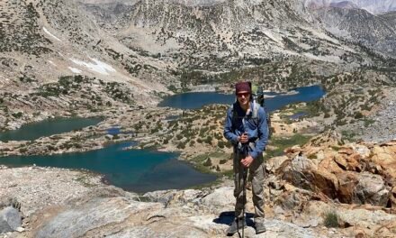
Last year after the wind storm hit Mount Hood, I explored the trail from Top Spur to the Mazama Trail. The trail was a real mess with blowdowns everywhere and some parts being virtually impassible. That was almost a year ago. I would have liked to go back earlier but this weekend Hunter and I decided to head up to McNeil Point from Top Spur and check out the current state of the trail. I’d never been up to McNeil Point before – but I wasn’t holding up chances of a great view – the weather was predicted cloudy until later in the afternoon.
Getting To The Top Spur Trail Head
The route to the trailhead is pretty straightforward. Take the Muddy Fork Road off of E. Lolo Pass Road. Instead of taking the right across the bridge towards Ramona Falls Trailhead (and a few others) continue on straight on Forest Road 1828. Be warned – this road is pretty decent with the occasional wicked pothole. After about 5 and 1/2 miles the road splits and there is a sign-posted spur to the right – which is graveled. We left Portland at what I thought was a pretty early hour on a Sunday – admittedly 8 am – and arrived at the trailhead at around 9.30 am. It was pretty packed – with folks parking along the road as well as at the trailhead parking. Get there early – and you need a Forest Pass or day pass.
Trail Head to Timberline Trail / PCT Intersection
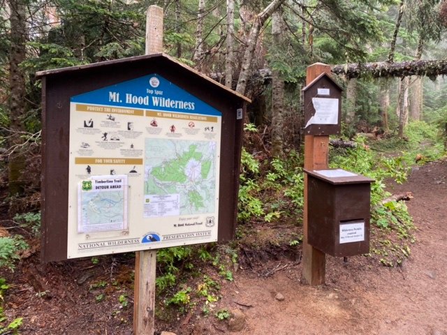
The start of the trail is a 1/2 mile climb from the parking lot to where 4 trails all intersect. The trail continuously climbs over the short distance – gaining about 350’. Just before the main intersection, the trail joins the PCT. This is the PCT northbound. A short distance after we arrived at the intersection of the four trails. This can be a pretty confusing place. You arrive at it from the PCT Northbound trail. The trail immediately to your right is the PCT Southbound – this is the reroute for the Timberline Trail at the moment. The trail immediately to the left is the Timberline Trail clockwise and the final trail is the Timberline Trail counterclockwise. There is also the self permitting wilderness box here.
Timberline Trail Clockwise
The section of the Timberline Trail between Top Spur and McGee Creek Trail was completely devastated by the windstorm. Last year it took over an hour to cover less than 1/2 a mile. At times we were three trees high of the ground. This entire portion of the trail has been cleared. Such a change from last year. You can really see how much work has gone into the maintenance of this portion of the trail. In this entire section, there was not one blowdown left.


Shortly after this section, you pass the cutoff trail that takes you back to the Timberline Trail counterclockwise and then on to the McGee Creek Trail. From there we climbed up the ridge. Last year this was also almost impassible. However now we found that even though the number of blowdowns was substantial – the trail had now worked its way around most of the blowdowns. There were still a few places where we had to clamber over the occasional log – but overall the trail has evolved to the new reality of so many blowdowns. We could still see all the damage that had happened in this section.


The trail to McNeil Point
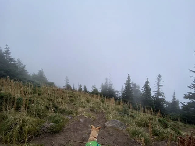
After the blow-down section – Hunter and I emerged to what is usually some spectacular views. The weather was not co-operating for views – but did allow for some wonderful Oregon atmosphere of clouds and light rain drifting across the trail. At the top of the ridge, the trail flattens out for the next 1 and 1/2 miles. There are a few streams to cross, the largest of which is McGee Creek – so plenty of opportunities to filter more water. After crossing the intersection of the Mazama trail there is another crossing of a tributary of McGee Creek and the McNeil pools. The McNeil trail takes off to the right after a total of about 3 and 3/4 miles. This is the longer way around to McNeil Point. There is a shorter and much steeper ‘boot trail’ that cuts some distance of this trip. The boot trail heads up some rock scrambles just where there are some signs for campgrounds after about 3 miles. Given the limited visibility, I decided to give this a pass.
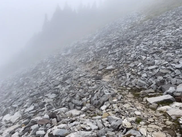
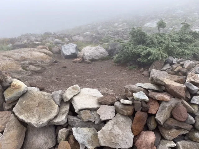
The trail up to McNeil Point follows a ridge above a tributary of the Ladd Creek before turning back southwest towards the shelter. There are a few portions of this trail that need a little care – and poles help. There is a 20-yard section of trail made from large aggregate rock – easy for a human, but a little less easy for a dog. And a few sections just need some careful navigation. There are plenty of potential campsites around McNeil Point. Many have rock walls built to protect them so this is clearly an exposed area.
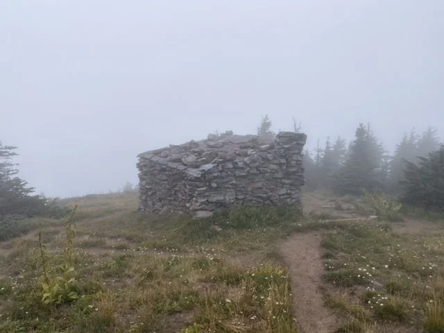
McNeil Shelter
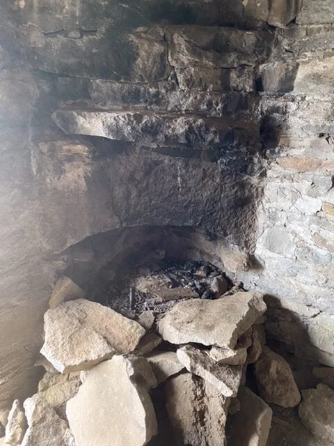
Finally, the shelter came into view through the mist. Becoming slowly more well-defined. The small rock shelter is in good shape – inside is a small fireplace – which Hunter decided to inspect. From the shelter, the boot track descends directly back down to the Timberline Trail. There were plenty of folks using it – but the information they provided was it’s pretty steep.

Protected camp site McNeil Shelter 
Complete with Fireplace
Hunter & I took the opportunity for a lunch break, sheltered from the wind. And then we retraced our steps back.

