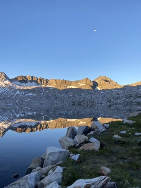
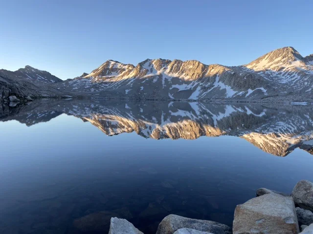
The morning of the fourth day of our North Lake South Lake loop hike was spectacular. The night had been calm and relatively comfortable, despite being at 11’500 feet. I looked out of the tent and the water of Wanda Lake was mirror flat with the morning sun just breaking on the mountain tips and the moon hanging in the sky.
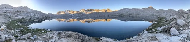
I spent some time taking in the breathtaking scenery, realizing this might be a once-in-a-lifetime view. And as the sun started to warm the waters, ripples appeared and the mirror-like stillness was broken. One of my regrets from this trip is that neither Keenan nor I were apt to taking any night shots – this would have been the perfect location to see the Milky Way.

Moon of Wanda Lake 
Mountains Mirrored in the Water Leaving Wanda Lake towards Muir Pass

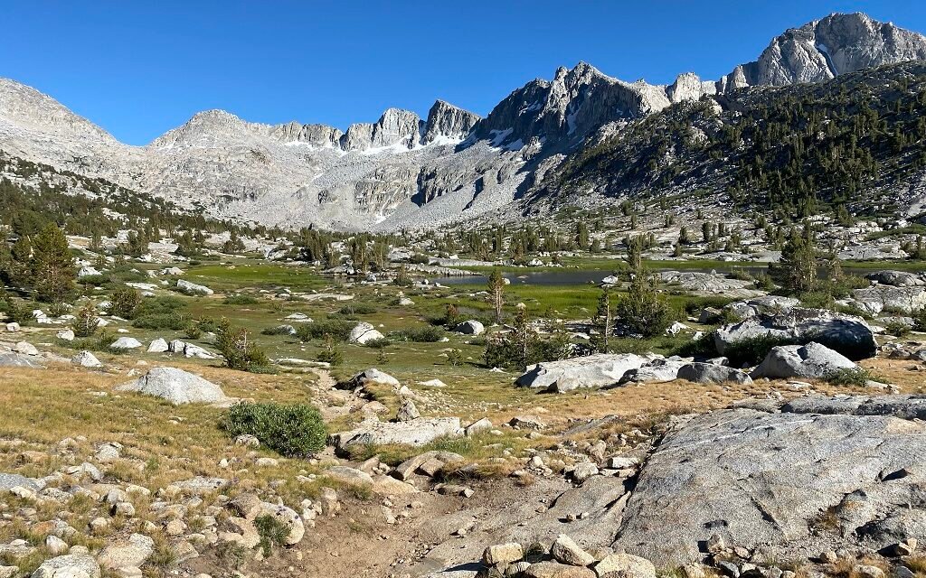
The climb to Muir Pass was neither long nor steep, rising about 500 feet from the south end of Wanda Lake. However, climbing to almost 12’000 feet is strenuous. I was glad we were doing this in the coolness of the early morning. Wanda Lake dropped behind us, but Muir Hut was hidden. We passed McDermand Lake as we made our way to the pass.
One of the reasons I had picked this hike, was to see Muir Hut. For me, this is one of the most iconic images of the Sierra and representative of the naturalist John Muir who was instrumental in the creation of the National Park system.
As we neared the summit, the round stone roof, started coming into view. Signaling that we were just yards from the summit. And then finally we were there, standing at 11’955 feet – the highest point I had been to date.
Plaque in Muir Hut Matt outside of Muir Hut Keenan outside of Muir Hut 
Panorama looking north


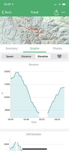
We stayed for a short while at Muir Pass and then started our descent down the southern side. The descent from Muir Pass to the low point in LeConte canyon is 3000 feet. It was a long downward trek, roughly divided into three different sections. In the first section, we were still in the alpine area. Alpine lakes, few trees, and a path that, although well maintained, was hard on the feet. Rock steps, mixed with rock infill kept us on our toes. Descending can be as hard as the uphill and this was tough on the ankles and calves.
Helen Lake Middle Fork of the Kings River Simple stream crossings
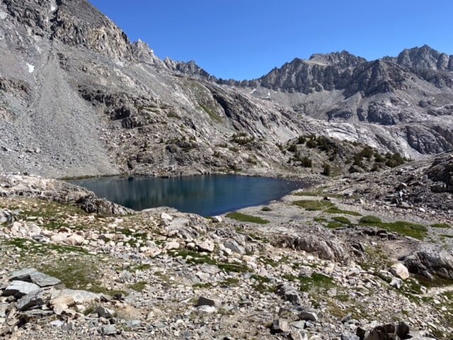


This side of Muir Pass was starkly different – rugged and hard. However, even here is the start of life. From Helen Lake, there was the continuous flow of water, the very beginning of the Middle Fork of the Kings River. Starting small, a trickle through the rocks, but ever getting larger as we dropped. The creek getting louder, small waterfalls coalescing into larger waterfalls. It’s impressive to think that Muir Pass is the divide between two watersheds with water on one side flowing down and eventually into the Kings River and the other side into the San Joaquin River.
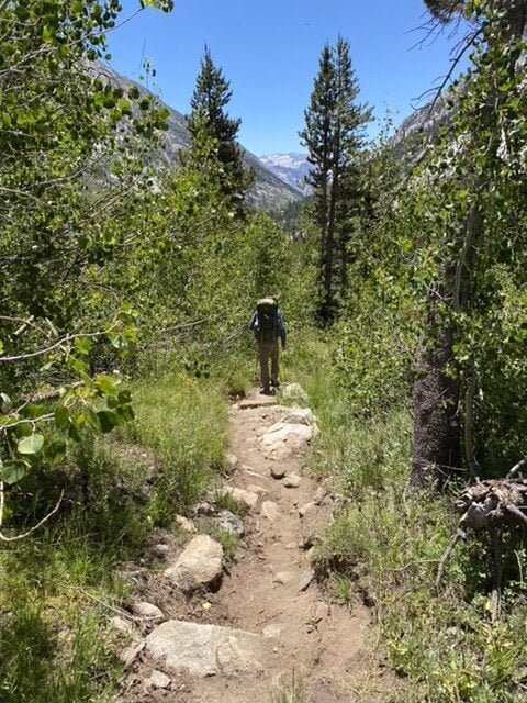
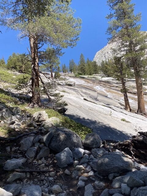
We continued down. Slowly the landscape changed as we descended lower. There was an increase in pines and occasionally their aroma would cross the trail. Descending into LeConte Canyon it was more the smells that changed, going from the clear, fresh pass air, back down into the forested canyon with its familiar pine scent. The flora returned and eventually, the trail became soft underfoot and we could cover mileage at a quicker rate.
Leaving the Alpine Area Looking down into LeConte Canyon Return of forest flora


We met several groups of hikers heading up to Muir Pass, just as it’s a long way down from Muir Pass to the valley floor, it’s a long way up too. A 3000-foot climb is challenging, so we smiled with encouragement, careful not to say they didn’t have too far to go when in reality they did.
Eventually, we reached the canyon floor. Plenty of large camping sites, indeed it was good that we camped on the north side of Muir Pass as there were very few good campsites on the south side for the first couple of miles.
At the junction with the Bishop Pass Trail, our time on the JMT was over. The LeConte Ranger station was here but again closed for everything except emergencies. We broke for a long lunch, preparing ourselves for the ascent to Dusy Basin. A hard 2000 ascent over 2.5. We met several hikers coming down the Bishop Pass trail and they were honest that the slog up to Dusy Basin would be a grind. They were not wrong.
The trail Bishop Pass trail immediately went into a series of steep switchbacks following the river almost vertically up. The river descending from Dusy Basin careened over the bare rock, looking like a circus heater skelter.
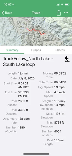
The 2000 feet to Dusy Basin were hard and this had been a long day at almost 13.5 miles. Dusy Basic itself was a mystical place, a maze of different places to explore with many options for campsites. Some on hard rock and some under trees. We tried one on rock and decided it was not the best so we moved, further off the trail but to a better location. Under the pines and close to a little stream for water. It’s always worth going the extra yard for a good campsite.
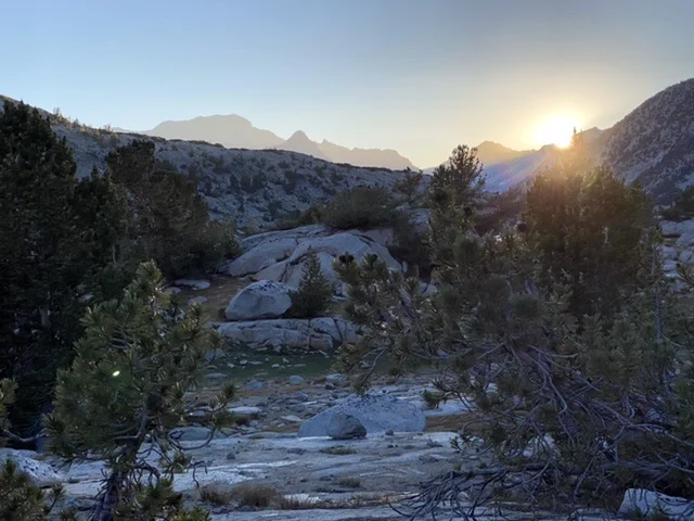
Sunset over Dusy Basin Plenty of Wildlife Second Campsite!


Unfortunately, the mosquitoes were the worst here that we had experienced and sent us to our tents quickly after the sun had set. We had now jumped a day ahead versus my original plan. I had suspected this might happen as in my original plan we had two campsites which were just a few miles apart and we had now just leapfrogged over one of them and unfortunately, this would also mean that tomorrow would be our last day of our North Lake South Lake loop hike.


