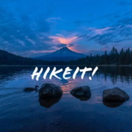
The hike to Warren Lake, from the Columbia River Gorge, is hard and steep. Although it might be unfair to call it a destroyer of knees, this hike will test your stamina both n the ascent and the descent. The hike to Warren Lake on the Mount Defiance trail is a test of stamina, with the reward being Warren Lake.
Introduction
I decided to tackle this as a day hike, although it would also make a good backpacking trip, with many options after you arrive at Warren Lake. I had done this trip several years ago and thought it was time for a repeat. Over the Labor Day weekend, finding longer hiking spots was getting a little tricky with an increasing number of forest fires in the area and a seeming lack of enthusiasm from the kids. However I managed to persuade my eldest, who has backed off from hiking somewhat to come along, with of course Hunter who is game for anything,
The trailhead for this hike starts at the Starvation Creek Trailhead, this is exit #55 on I-84 east. There is only an eastbound exit. There is limited partying and on Sunday it was already full by 8.30 am. I had originally intended this to be a loop hike . Taking the Starvation Ridge trail and then cutting across to Warren Lake and descending on the Mount Defiance trail. However, the Starvation Ridge trail was closed due to power-line maintenance. So with a quick bit of re-adjustment, we decided on an out and back to Warren Lake.
The first two miles
We started this hike at about 8,30 at the Starvation Creek Trailhead and walked towards the Mount Defiance Trail. This part was at least flat and follows I-84 on the old Columbia Gorge Highway. This was pretty much the only flat part of the hike. At the Mount Defiance Trail, we start the climb. There were some very cryptic signs from a power company indicating that some trails were closed – however it was very hard to work out which. From the Mount Defiance Trailhead, we started to ascend. The initial ascent was fairly mild, leading us up to where they were stringing some new power lines. However, as soon as we were above the level of the power lines, the trail became steep.
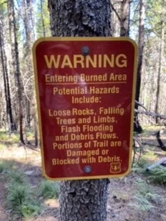
There is little that can describe the next mile except it’s a set of steep switchbacks, intermingled with steeper climbs. Unforgiving. There are no respites of flat terrain. In places the trail is so steep it becomes a scramble. This is definitely where four legs are better than two. After a short while, the trail intersects with the eastern edge of the Eagle Creek burn area. Often this seems to have only impacted the understory and there is still a green canopy, but later the burn is more extensive.
Underfoot the impact of the burn area is that the trail was loose and dusty. This made getting a foothold in some areas more difficult.
The Ridge Walk
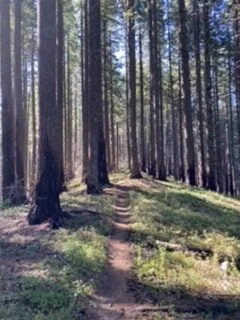
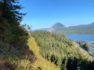
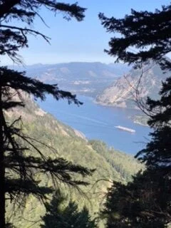
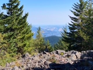
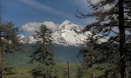
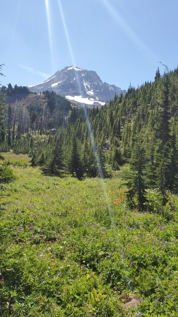
After about 2 1/2 miles and a gain of about 2000’, we finally hit a flatter part of the trail which follows the ridgeline. This was certainly a welcome respite for the initial climb and for about the next 1 1/2 the trail continues a steady ascent but nowhere near the initial steepness. There are occasional views down the Columbia River Gorge. Initially, these are to the west but as you get higher there are the occasional views to the right as well. It’s really clear from the views how quickly we were climbing.

Lower Elevation Looking West 
Looking West Looking East
Ascending again and on to Warren Lake
After the ridge climb, the trail started to ascend more aggressively. It did this all the way to the intersection with the Warren Lake trail. Our plan was to descend to the Warren lake, a drop of about 500’, however, we could carry on to the summit of Mount Defiance on this trail – which would be about another 750 foot gain.
The trail down to Warren Lake is not too steep but does have some very rocky areas – not necessarily ideal for Hunter. However, he’s a trooper and navigated it all very well.
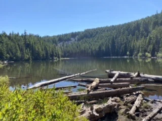
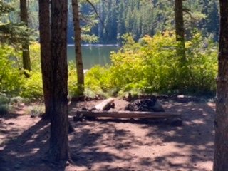
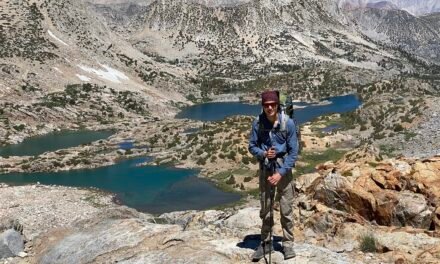
Warren Lake itself is a small lake. There are several established campsites around the lake and these would make an excellent stopover. You could easily camp here and either turn the hike into a small backpacking adventure or push deeper towards Mount Hood.
We took a well-deserved lunch break at Warren Lake. Filtered some water and refilled our bottles. Hunter spent a little time trying to snatch a few flies from around him.
Overall this is a pleasant lake, the water was clear and there were only a few bugs.
After a 30 minute break, we had the return journey to look forward to. You could continue on from here and meet up with the Starvation Ridge Trail and head back down that way – however, for us, we had to return the way we came.

It’s fair to say that the journey back was also difficult. Long downhill sections are wearing on the knees – particularly as you get older. Also, the trail was steep and loose so keeping a good footing was tricky. This is especially true towards the end where the trail is at its steepest and in certain areas it was hard not to slip.
Despite the severity of this trail there is always something satisfying in pushing yourself. The total elevation change for this hike was over 6000’ which is certainly an accomplishment for anyone. It’s also a great training hike if you are considering an ascent of Mount Hood or Mount St. Helens.
Statistics
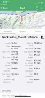
Here are the statistics for the trip:

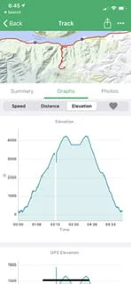
Summary Elevation
FAQ
- Long, grueling uphill hike on pretty rough terrain
- Make sure you bring enough water and/or plan to filter at Warren lake
- The trail intersects the edge of the Eagle Creek burn area
- The burn area makes the trail a little loose underfoot and dusty
Viewranger Data
You can find this hike and download the route here.
Here’s the 3D Flyover of this route.

