
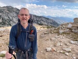
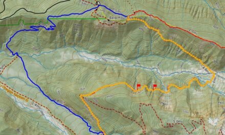
There is so much to share from a trip like the JMT. To give you an overview of the entire JMT hike you can follow the timeline here. This tells the story from Horseshoe Meadows to Yosemite Valley. Click on a photo to find out more details on any day. Here are the complete details of our JMT hike.
Timeline
 We set off on the way to Cottonwood Pass. Our first pass was at 11’200 feet. Looking south were the softer hills of the southern Sierra, looking north were the many peaks of the High Sierra, whose passes and canyons we’d be navigating in the upcoming days.Distance: 11 miles; Ascent: 1975′; Descent: 1463′
The second day was to get us to Crabtree Meadows. This is the setup for the side trip to the top of Mount Whitney. The eastern panoroma was a growing set of jagged mountain tops, one of which we would be ascending tomorrow. We are starting to get used to our new homes for for next 2 weeks!
Distance: 10.7; Ascent: 2060′; Descent 1876′

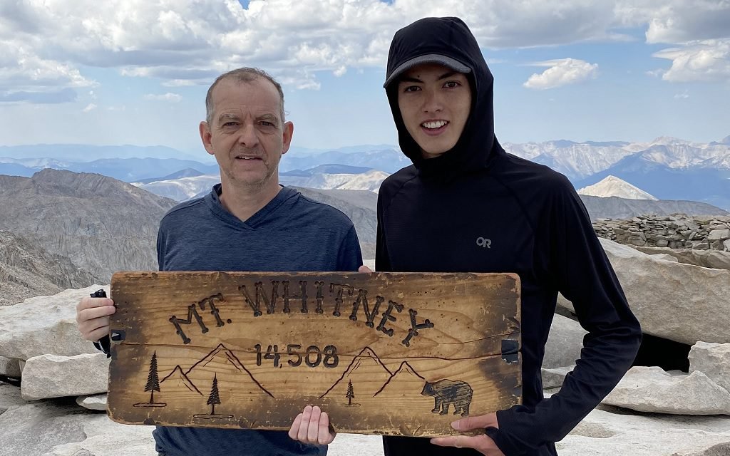
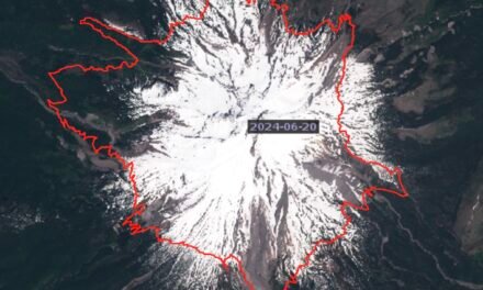
We started early. Passing iconic Guitar Lake we began the long climb up tight switch backs to Trail Crest. The switchbacks pulled us high above the lakes we had passed earlier in the morning. The 1.9 miles from Trail Crest to the summit were long and hard. The trail was mainly talus, with canyons and couloirs dropping off precipitously. Eventually we ascended the final crest and the famous hut came into view. Standing on the summit of Mount Whitney – the start of the JMT.
Distance: 14.4; Ascent 4990′; Descent 4993′

An early afternoon thunderstorm set-in. This would be a pattern for the next few days. We set off on the major portion of our journey, our next target being Muir Trail Ranch, over 100 miles to the north. We transitioned out of lodgepole pine forest, passed through the Bighorn Plateau, until we had to shelter in mid-afternoon for another thunderstorm.
Distance: 12; Ascent: 3005′; Descent: 1404′

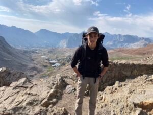
We were up early to climb up to Forester Pass – the highest pass on the JMT (and PCT) at 13’200 feet. The ascent was a brutal set of switchbacks tight into the rock wall, with the trail sometimes blasted into the rock itself. The top of Forester Pass marked the transition from Sequoia to Kings Canyon National Parks. From the top, looking north, was a sea of mountain peaks and high passes – many of which we would need to cross.
Distance: 14.8; Ascent 3503′; Descent 5219′

An early morning start had mirror lake reflections on Rae Lakes. Today we had a long ascent to set us up for Pinchot Pass. However the trail took us by the beautiful Rae Lakes, Arrowhead and Dollar Lake. Rangers mentioned bear activity but we had seen none. We descended following the south fork of the Woods Creek until we came to the single person suspension bridge.
Distance: 11.2 miles; Ascent 2545′; Descent 2194′
Another 2 pass day! We used our set-up position to clear Pinchot Pass early in the day and then drop down by Lake Marjorie. We followed the creek down passed the Bench Lake and Taboose Trail intersections and then on its long ascent to Mather Pass. From the top of Mather Pass we had a clear view down to the Palisade Lakes and headed down to camp by the north lake.
Distance: 15.9 miles; Ascent: 3690′; Descent: 3982′

From the Palisades it’s a steep drop into Le Conte Canyon. The first part of this is down the Golden Staircase. A set of 50 tight, stone-step switchbacks that cut their way down through gullies. There was the beautiful aroma of wild herbs as we wound our way down. The steep descent ended and we followed Palisade Creek until it joined the middle fork of the Kings River. Heading north we had lunch at the Bishop Pass Trail turn off and were back on familiar ground from last year’s hike. We knew now we had the long ascent towards Muir Pass, leaving the meadows and rising through the forest and back above the tree line.
Distance: 15.3; Ascent: 3375′; Descent 3277′
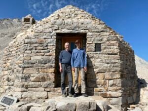
After a short hop to Muir Pass we reached the iconic Muir Hut. From there we started our traverse through the amazing Evolution Basin. This stretch is possibly the most beautiful part of the entire journey. Both Keenand & I completed this last year and the area never ceases to amaze me!
Distance: 16.1; Ascent 1574′; Descent: 3772′

Evolution Creek joined with the South Fork of the San Joaquin River and as we passed the Piute Pass Trail we were once again in new territory. After 10 days of hiking through the wilderness we arrived at our resupply point – Muir Trail Ranch. We had sent a bucket of food here. Since the start of our journey our packs had lightened from about 40lbs to under 30lbs. A much lighter load! Working out the resupply only took a couple of hours and then we were off again, with heavier loads, to set-up for Selden Pass.
Distance: 10.7; Ascent 2732′; Descent 921′

This was to be a short day. We’d secured a reservation at Vermillion Valley Resort – but would have to slow down to arrive on day 12. Crossing over Selden Pass gave a beautiful vista of Marie Lake, which we descended towards before dropping down into the canyon and following Bear Creek. Bear Creek was still flowing well and had numerous beautiful swimming holes along its route. In a high snow year Bear Creek can be the most dangerous creek to cross, but again it was just a rock hop.
Distance: 9.33; Ascent: 826′; Descent: 2034′
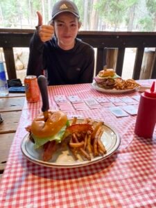
We hurried so we could be at VVR for lunch. Vermilion Valley Resort, on the side of Lake Edison, is a common hiker stopping point on the trail. It was an opportunity to have a shower, launder clothes and have real food (and beer). We arrived just in time for lunch. All the food was excellent. We met many other hikers and had fun exchanging stories. Getting clean was super refreshing after 11 days on the trail!
The resort was almost destroyed by the 2020 Creek Fire and you could see the fire damage and burn areas all around.
Distance: 8.38; Ascent: 1158′; Descent: 2460′
Leaving VVR was tough – but after a full breakfast we returned to the trail. The first part followed Lake Edison and was all in the burn area from last year. However we quickly rejoined the official JMT and started to ascend towards Silver pass, following Mono Creek. Since descending from Evolution Basin, more of the trail had been in forest rather than above the tree line, today we again escaped to higher ground for some sweeping vistas, but quite the climb.
Distance: 14.9; Ascent: 4271′; Descent: 2198′
We were eager to leave our camp spot; cold and mosquitoe ridden. Today we had an opportunity to make it to Reds Meadow – another resort property where we could get food and a shower. This would be helped by a relatively long descent, most of it through light forest, which makes the going good underfoot.
There were still incredible views as we passed Lake Virginia and Purple Lake (which was not purple!).
Distance: 19.1; Ascent: 2801′; Descent: 4931′

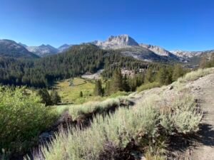
At Reds Meadow we had dinner and breakfast as well as a shower and then set up for the day. Mainly a day of ascent – but passing many beautiful lakes. Gladys, Rosalie and Shadow Lakes all pristine. Then we crossed over to Garnet Lake and finally Thousand Island Lake. As its name suggests the lake is dotted with many small islands providing a unique appearance. This provided the perfect backdrop with Mount Ritter and Banner in the background.
Distance: 15.8; Ascent: 4452′; Descent 2687′

The views of Thousland Island Lake were spectactular as we ascended towards Island Pass. Donahue Pass, the last major one, is the entrance into Yosemite National Park. Donahue was still tiring, with many stone steps on both sides. From the top we could look back and see across how much of the Sierra we had travelled. Looking forward we could see down into the meadows of Lyell Canyon and the the meandering Lyell River.
Distance: 14.5; Ascent: 2139′; Descent: 3051′

We started with a 6 mile hike through Lyell Canyon to Toulumne Meadows. Another opportunity for some cooked food and a quick resupply before continuing for our final pass and some spectacular Yosemite sceneary. Cathedral Pass is small compared to others, but is flanked by the spectacular Cathedral Peak. We ended with our last nights camp being at Sunrise Lakes which set us up for a beautiful morning of our last day.
Distance: 18.9; Ascent: 1909′; Descent: 1496′

The final day was one of constant descent; through large burn areas, along forested trails and down the steep steps of the Mist Trail. Ever descending to the valley floor, the temperature rising as we got lower. Ever mixing with more day hikers from Yosemite, until finally we arrived at our destination – Happy Isles!
Distance: 12.2; Ascent: 918′; Descent: 6148′


