
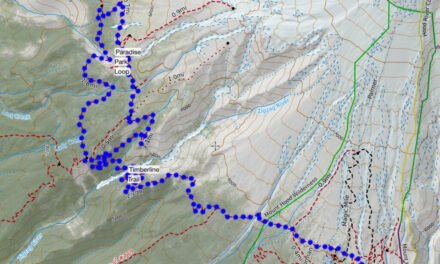
Fairly often you’re see that I post satellite imagery, especially of the current snow conditions overlayed over certain trails. I find this is a useful additional tool to work out whether I feel comfortable on a particular hike. I should stress that its only one of many you can look at to see what the trail conditions are and I’d absolutely recommend getting on-the-ground trail information from folks who have recently hiked or the local ranger station. There are also many snow sensors that provide a reading of the snow depth and the snow water equivalent for different areas. So how do I make the satellite overlays?
Where does the imagery come from?

The satellite imagery is free. I use a set of imagery that comes from the European Space Agency as part of their Sentinel Project. The best imagery comes from their Sentinel-2 satellite. This is an amazing set of high resolution imagery that is freely available. These are somewhat analogous to what the US has with the Landsat program.
Sentinel-2 has a resolution down to about 10m. The orbits of the satellites give a view over the Sierra maybe every 3-5 days and over the more northern areas of Mt. Hood and Mt. Rainer a little less frequently.
Viewing the imagery
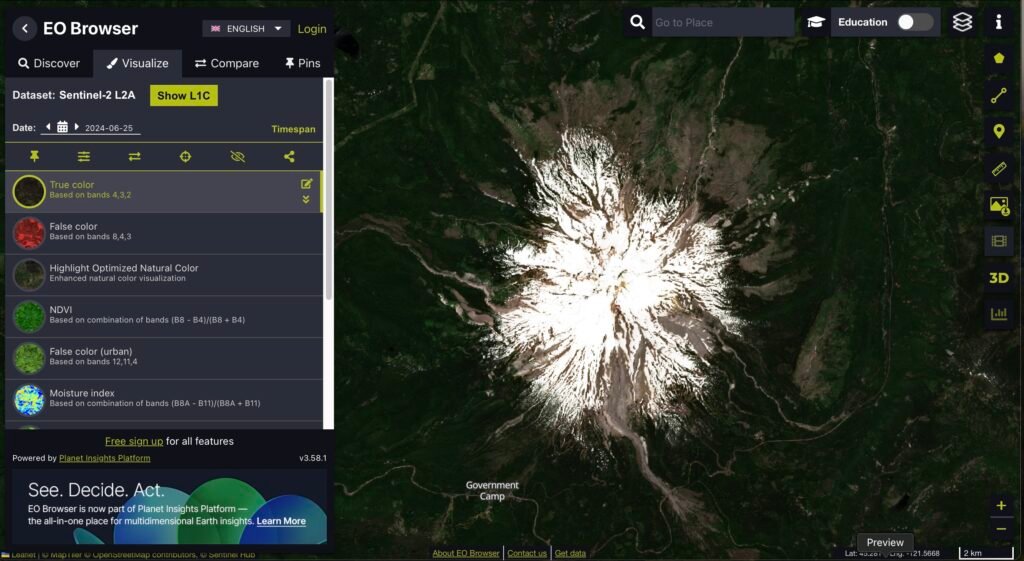
You can freely view the imagery through the browser provided by the ESA. This will actually show you.a range of data from different satellites. The browser is very powerful, bit not the easiest to use. However with the browser you can see there imagery. The example below is of Mount Hood, on the 25th June.
Now you have all the basic information and can browse all the satellite imagery. You can have a lot of fun playing around with this, it has fantastic 3D view and different data bands to experiment with.
How do you get a trail overlayed?
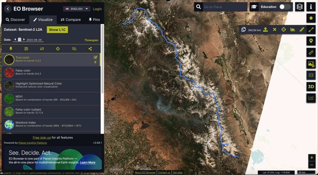
Now the real trick is how can you easily get a hiking trail overlayed on the image? You can upload a GPX file into the browser. This works very well, as you can see in the example below of the John Muir Trail.
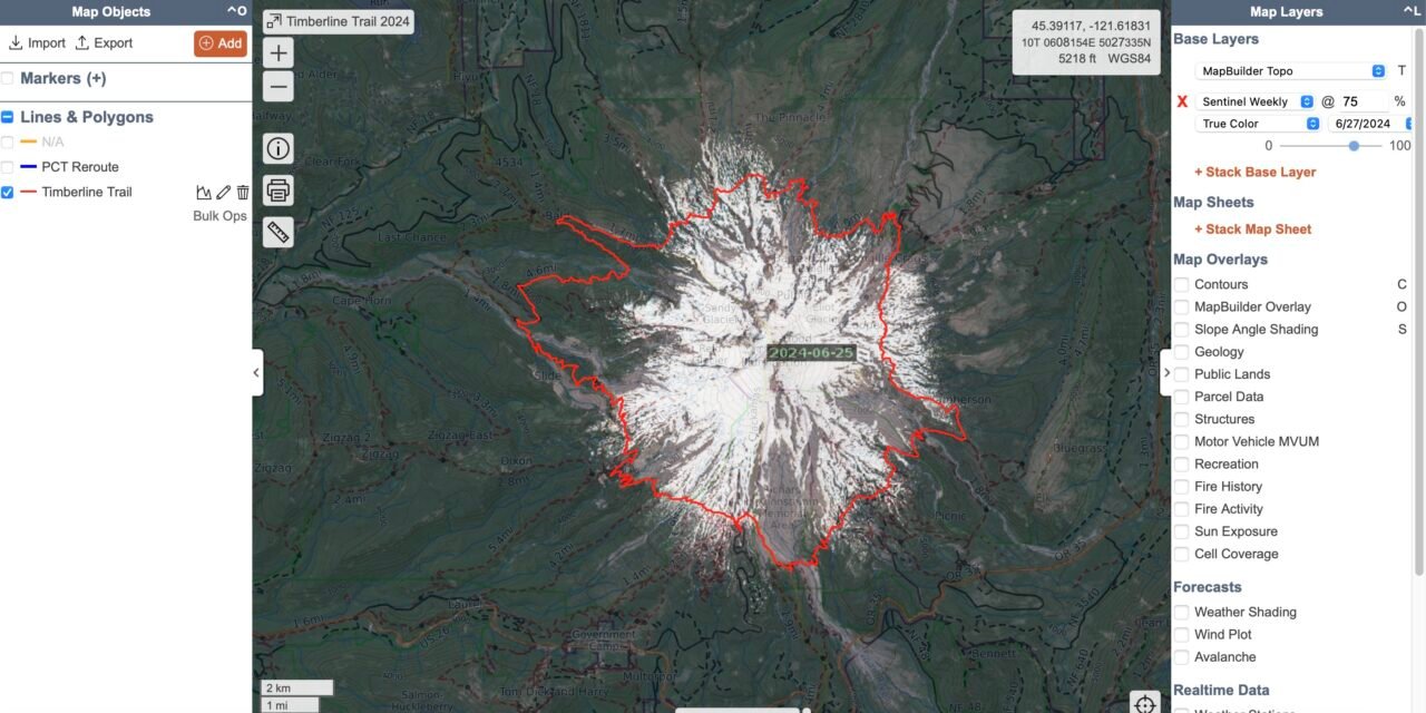
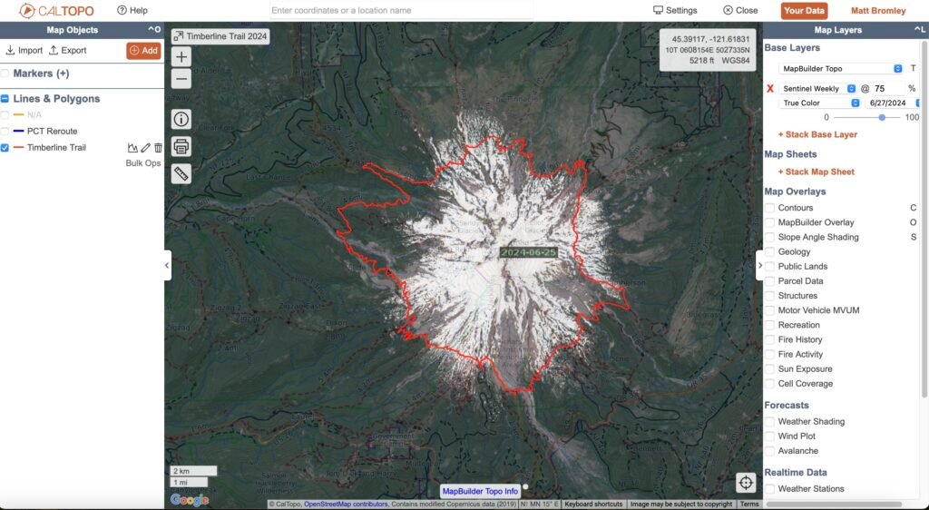
The easy solution – CalTopo
CalTopo is a great product. I use it a lot for creating hiking routes. It’s an incredibly powerful product and you get a lot of capabilities with their free product. I have their subscription for $50 / year. With that one of the features you get is to be able to automatically overlay the the Sentinel-2 imagery. I already have many of my hiking routes saved in CalTopo. Overlaying the satellite image is very quick. You also get to pick the date of the image that you want top use. This makes it very easy to compare the snow level between months or years.
And then for Facebook I just take a screen shot of the image and post it – viola – that’s how to make satellite overlays.

