
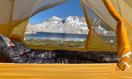
We are only at the end of March and folks are already starting to plan their summer hikes around Mount Hood on the Timberline Trail. One of the common questions that I hear is when do you think I can start my hike? There are many factors that impact the beginning of the hiking season around Mount Hood – personal ability, state the rivers and the one that comes up frequently is the amount of snow on the trail. Let’s look at how the Mount Hood Snowpack in 2025 is shaping up.
The Timberline Trail varies in elevation from a low of around 3264′ at the Sandy River, to a high of 7331′ just after Cooper’s Spur. The snow tends to hang on the north and north eastern faces of Mount Hood longer than it does on anywhere else. The many canyons and steep traverses can be much more difficult when they are covered in snow.

If we take a look at last year – June 20th – the image shows the Timberline Trail superimposed over a satellite image of Mount Hood. It’s easy to see that there are many areas of the trail that are still under snow. Indeed it is only the lower elevation on the west side that are largely uncovered. In 2024 it was not until mid to late July that the trail was predominately snow free.
For a more detailed view of the snow last year – you can check out my post about heading up to Paradise Park, on the 11th June. There are definitely some challenges when traveling across snow:
- Navigation can be much. more challenging. Without a trail to follow you need to be much more comfortable with your navigation skills.
- Even short exposures across snow can be very difficult. 20 feet of snow across a trail might not look like much, but if it is a steep exposure that has no safe runout then that can spell trouble.
- Snow travel requires special equipment: whether that be microspikes, snow shoes, and ice axe or Whippet.
Understanding Snowpack and Its Importance
Snowpack refers to the layer of snow that accumulates on the ground over the course of winter and spring. It consists of snow, ice, and sometimes water, which builds up when snowfall exceeds melting. Snowpack is measured by its depth and water content, with the latter being especially important as it indicates how much water will be available when the snow melts. The snowpack serves as a critical water reservoir, gradually releasing meltwater into streams, rivers, and reservoirs as temperatures rise in the spring and summer. It plays a vital role in ecosystems and water supply, particularly in mountainous regions like Mount Hood.
How does snowpack impact the start of the hiking season?
- Higher than average snowpack will generally keep snow longer on the mountain. This does depend on the spring and early summer weather as this will determine the rate of melt.
- Many of the trails on Mount Hood and the Timberline Trail itself are often impacted by fallen trees or washouts. These occur in the falls and winter months, or as the snow melts in the spring. Trail maintenance crews are often delayed if there is snow still on the trails. Indeed it is generally hikers that report the trail conditions that enable the trail maintenance crews to plan their work (shameless plug for Trailkeepers of Oregon).
- Higher snowpack can mean higher run-off of the major glacial streams around Mount Hood. These can be some the most challenging aspects of the Timberline Trail. If you are traveling across late season snow – you may find unstable snow bridges at the end of the seasons, or more aggressive stream crossings.
Mount Hood’s Snowpack History and Trends

As of March 22nd we are running at about 111% of the average annual snowpack. With a couple of snow falls predicated in the next week, this is likely to increase a little more. You can get the live data from the Snotel site.
Generally the snow pack will increase until about the end of April. However there are years which have been noticeable exceptions.
- 2020 saw the peak snowpack in early April, however the melt from then on was relatively snow and followed the average.
- 2016 saw a similar early snowpack, but in this instance the overall melt was rapid and the snow sensor was free of snow by early June.
The two extremes of the range on the graph are 1997 when we were at 184% of average with a peak on the 7th May and 2015 where we were only at 34% of average with a peak on 17th April.
What does this mean for the hiking season?
How Snowpack Affects the Hiking Season
I have been running the Timberline Trail survey for the last 3 years. The first reported hikes for each year have been:
- 2024 – July 4th
- 2023 – June 16th
- 2022 – July 22nd
A note on the 2023 report – this was a guy who summitted Hood and hiked the Timberline Trail on the way back. He said that submitting was much easier than the hike!
It’s still very early to predict who the snowpack will develop for the rest of spring and how the snowpack will melt as we head into the early summer. However given the current level of snow and the historical trends – it seems safe to think of mid to late July being the earliest to start planning for a Timberline Trail circuit.
You can also find me on Mastodon: @mattbromley@mastodon.social
Sign up for add free, algorithm free social media at social.hikeit.info

