
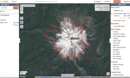
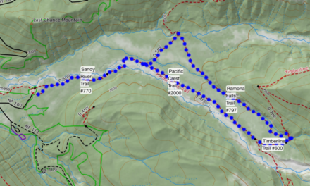
The windstorm of September 2020 caused considerable damage on Mount Hood – particularly on the west side. The map below attempts to provide a recommended reroute for the Timberline Trail reroute for 2021. This is based on information reported from various sources and my observations. Check with the Mount Hood National Forest ranger station before embarking on the Timberline Trail for the most up to date information.
Updated on 22nd August!

This map suggests the following changes to the standard Timberline Trail Route:
- Closure of the Timberline Trail from Ramona Falls to Top Spur along Yocum Ridge – use PCT – Jim Wilson has a great post on this.
- Closure of Timberline Trail from Top Spur to McGee Creek Trail – this is now fully open!
- Timberline Trail clockwise from Cutoff Trail toward McNeil Point – although there are many downed trees, the trail now navigates around many of them – this section is really very passable with just a couple of difficult logs to navigate.
- Taking the Paradise Park Loop Trail instead of the Pacific Crest Trail – it’s just more beautiful
In Google Maps:
Or in CalTopo:
If you have any other recommendations to add to this Timberline Trail Reroute 2021 please leave a comment.
Check out my trip report for more details of hiking the Timberline Trail.
You can download the GPX for this here
.
![Timberline Lodge Parking – [Updated for 2025]](https://hikeit.info/wp-content/uploads/2021/09/Timberline-Carpark-1024x768-1-440x264.jpg)


Thanks for the trip report. Is there any updated info available on the Sandy River crossing?
Keep an eye on the Timberline Trail Facebook group – there are now reports coming in from the first few folks who have completed the trail. I read one report that indicated that the log crossings have been washed away and there is an attempt to rebuild them