

I can’t believe I haven’t written a report on Ramona Falls! I’ve hiked this trail many times – often multiple times a year. It’s definitely one of the gems around Mount Hood. I’ve done this both as a day trip and as a lazy overnighter. This is a 7.5-mile balloon hike. It’s generally pretty easy and gains a total of about 1000’ over 3 1/2 miles. The biggest challenge in this hike is crossing the Sandy River. This can be very variable depending on the time of year and time of day, and where the occasional log ends up. It’s also a very popular trail. A couple of years back a ranger told me that the Ramona Falls Trail was the most popular wilderness trail in Oregon.
Ramona Falls Trail Head
The trailhead is at the end of the Muddy Fork Road. There is a large parking lot that can accommodate around 50 cars. However, this is a very busy trail and the parking lot fills up pretty quickly at weekends. There are portable restrooms and trash cans in the parking lot.

Parking Lot at 9am Parking Lot at 1pm 
Trail head signage


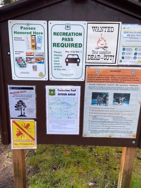
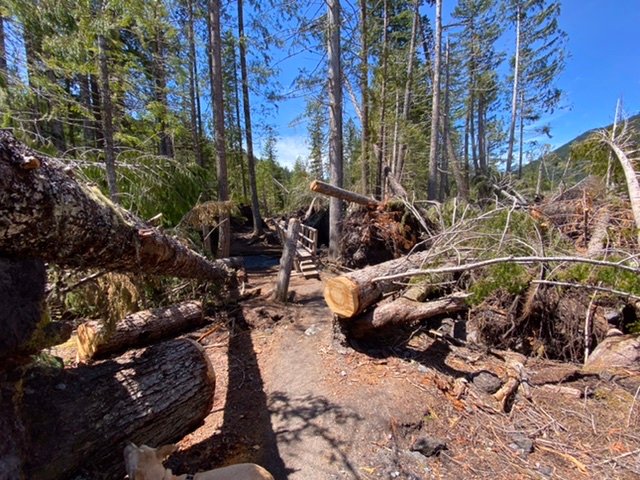
The parking lot requires a usage fee – a Northwest Forest Pass works very well. Note that the USFS has officially rerouted the Timberline Trail in this area onto the PCT. The trail from the trailhead follows the Sandy River for the first 1 1/4. It’s clear that the windstorm from last September has also downed many trees along the trail. The Forest Service has done a great job in clearing the trail. The only real challenge in this hike is crossing the Sandy River.
Crossing the Sandy River
Crossing the Sandy River is always a bit of a crapshoot. There is no bridge and conditions can change quickly. There are often logs that have conveniently got wedged across the river. The flow of the Sandy River can vary a lot – it’s really important to keep an eye on weather conditions. In 2004 a hiker drowned crossing the Sandy – however, that was after a rainstorm that deposited 10 inches over 4 days. Be particularly careful early in the season – the flow rate will drop a lot in the late-season – August / September – and it can also be less in the morning as the amount of snowmelt is less. If you are unsure of river crossing techniques, the PCTA has some basic advice. If you have any concerns then I’d definitely recommend turning around and coming back another day.
Currently, the river seems to be low and there are two viable log crossings. Although I suspect a walk-through would also work if you wanted to. One of the logs has a rope that forms a kind of handrail. This seemed to be the most popular. The second option has a slightly thicker log but it is only secured at one end – giving it a good deal of bounce.
Log with rope Alternate Crossing


The trail to Ramona Falls

After crossing the river – the trail passes across a sandy area, which makes a great camping spot if you want to turn this into an overnight backpacking trip. It then follows the Sandy River towards Mount Hood, along the top of the canyon. This used to be a pretty enclosed trail, well shielded from the sun. However, I definitely have the feeling that it’s more open now and brighter. There are definitely lots of blowdowns, but again the Forest Service has kept the trail clear.
After about 1 1/2 mile there is a junction where the Pacific Crest Trail bears of to the left. This is the northbound PCT – and forms part of our return journey. Continuing straight is the PCT south and the way to Ramona falls. Rhododendrons grace the trail and this is a great time of year to be out there – just as they are starting to bloom.
Just after mile 3, the PCT trail peels off to the right down towards the Sandy River. This forms parts of the Timberline Trail around Mount Hood and will take you back to Timberline Lodge. The way to Ramona Falls starts to drift away from the Sandy River for the last 1/2 mile.
Ramona Falls

There is a reason that Ramona Falls is so popular. It’s truly a magical place. As you get close you can hear the falls and feel the cool air. There is a wonderful area right in front of the falls where you can take a break, sit and relax – taking in the beauty of the moment. This is a perfect spot for a snack or lunch.
The light can play magically on the water, as it dances across the rocks. There are certainly larger waterfalls in Oregon – but Romana Falls might be the most serene.
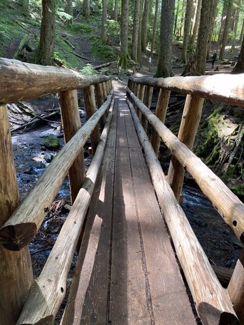
From here there are two options to return to the trailhead. Either return the same way – or continue on, across the bridge and return on the Ramona Falls Trail #797. This makes a nice loop.
We continued on across the bridge. Almost immediately after the bridge, the Timberline Trail bears off to the right. For 2021 this is not a recommended route for the Timberline Trail. The number of downed trees in this section makes it impassable. The detour is to continue on the Ramona Falls Trail and then joint the PCT north up to Top Spur and region the Timberline Trail there.
The Ramona Falls Trail
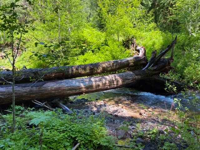
I really like the return on this trail. It slowly descends back towards the Sandy River. It hugs the creek from Ramona Falls, which is clear and sparkles as it meanders to eventually meet with the Muddy River. There are some nice camp spots on the other side of the creek just beyond mile marker 4. At about mile marker 5 the Ramona Falls Trail rejoins the PCT. Here you can follow the PCT Northbound (up to Top Spur). There is a crossing of the Muddy River. The good news is that crossing is still on some excellent logs.
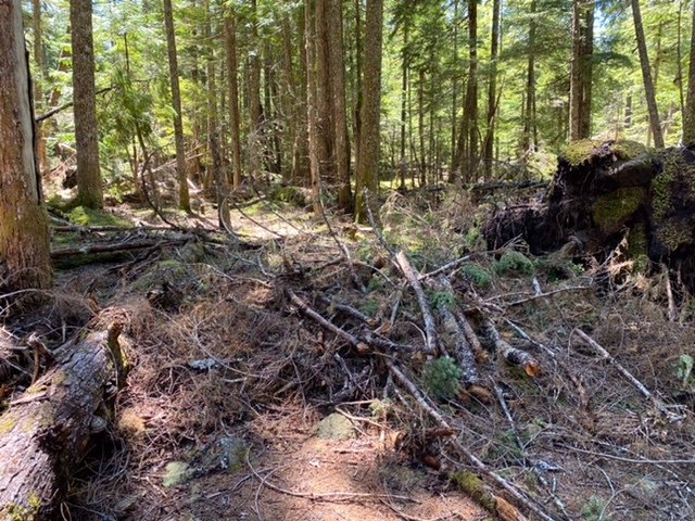
There also used to be a great campsite at the junction of the PCT and the Ramona Falls Trail. This was large and on both sides of the trail. It has often been a favorite of Boy Scout troops as you could get a lot of tents here. Unfortunately, there is a lot of slash across the area from the wind and it will need some cleaning up. It doesn’t look like there are too many toppled trees – just a lot of debris.
Following the PCT southbound again finishes the Ramona Falls loop and rejoins the trail just before the crossing of the Sandy River. There is a bridge that crosses the creek from Ramona Falls. This used to be a shaded spot, great for a quick break and maybe a good spot to gather some water from the creek, but the windstorm had really smashed this area hard.
When you rejoin the main trail the way back is the same way. Back across the Sandy River and then returning to the car park
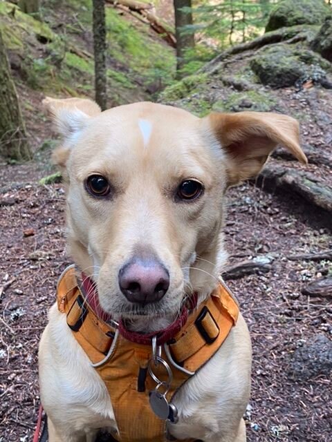
Very much an enjoyable hike. Of course, Hunter came along for the day – he’s pretty expert at log crossings by now! It’s also great to see so many people getting outside now that the pandemic is starting to become less of an issue.
Summary
- A gem of a waterfall!
- 7.5 mile round trip with a gain of about 1000′
- Much more open than in previous years because of downed trees
- Sandy River crossing can be difficult!
- Gets busy and the car park will fill up at weekends
- Fee area from Mid May – a NW Forest Pass works well
- Even thou busy – this goes into the wilderness – take appropriate gear and remember to fill out a wilderness permit at the box!
- Get a summary map here.

Summary Elevation


Do they plan to put a bridge in. I have bad knees and not sure i can get across.
I doubt it – they have not replaced any of the bridges around Mount Hood that cross the larger rivers and have said they have no intention of doing so. I believe the problem is it is really difficult to maintain those structures when the rivers move so much. Much of the canyon walls are soft and erode easily. Clockwise around Timberline you have to cross the ZigZag – usually the smallest, Sandy, Muddy, Coe, Eliot, Clark, Newton and White. I’ve always found the Coe and Eliot probably the toughest. If you are not comfortable on logs I’d wait until later in the season and walk through if the conditions look right.