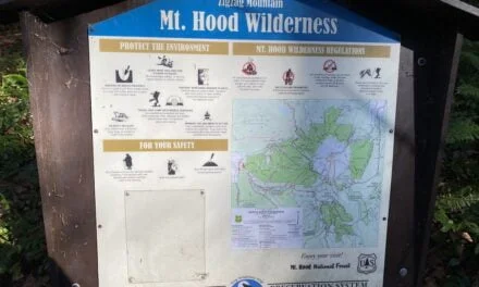
Right then, time for what might be the least thrilling but arguably most crucial post of the season. Mount Hood National Forest’s wilderness regulations are in effect year-round, and whilst they’re fairly straightforward, there are some proper nuances worth explaining — particularly this year.
The regulations themselves are available online, and they used to be helpfully printed on the back of wilderness permits. However, this year brings a rather significant change: those free self-issued permits that graced trailheads from May 15th through October 15th have vanished entirely. Beyond providing usage data for the Forest Service, they served as brilliant reminders of the actual rules — rather like having a cheat sheet in your back pocket.
With those handy references gone, it seems prudent to walk through the regulations properly. I’ve created a detailed map showing the affected areas, because sometimes a visual reference prevents the sort of “oh, I didn’t realize” moments that nobody enjoys.
Group Size: The Twelve-Person Limit
Group size is capped at 12 members, including both people and recreational livestock. This used to be charmingly referred to as the “12 heartbeat limit,” though dogs are mercifully exempt from this count — which is fortunate, given Hunter’s tendency to make friends on the trail.
If your group exceeds 12, the recommended approach is to split up and maintain separation throughout your hike. Start from different trailheads, keep apart on the trail — basically, don’t congregate like you’re hosting a wilderness festival.
Campfire Prohibitions: Where the Flames Don’t Fly
As of July 17th 2025 there is a campfire ban in Mount Hood National Forest
Campfires are banned in several specific areas, and the restrictions vary considerably in scope:
Within meadows — rather self-explanatory, this one.
Within the tree-covered islands of Elk Cove and Elk Meadows – see below for more details.
At or within 500 feet of McNeil Point Shelter — the 500-foot radius extends quite a distance from the shelter and includes some of the established campsites at McNeil Point. The map shows just how much territory this covers.

Within 500 feet of Ramona Falls — again, the map snippet reveals the affected area, which is more extensive than you might initially assume.

At or within half a mile of Burnt Lake — this is a considerably larger radius that encompasses all the official campsites at Burnt Lake. No exceptions here.

Within the Paradise Park PCT corridor — this one’s slightly more complex: the restriction covers the area above and 500 yards below the Pacific Crest Trail, from the north junction with Paradise Park Loop Trail #575 to the south junction. Essentially, it’s a blanket restriction covering all of Paradise Park.

Camping Prohibitions: Where You Can’t Pitch Up
Camping is forbidden in several key areas:
Within meadows — consistent with the campfire rules.
Within the tree-covered islands of Elk Cove and Elk Meadows — this restriction aims to prevent hikers from creating social trails across the meadows to reach these tempting islands. There are plenty of other camping options that don’t require trampling delicate meadow ecosystems.


Within 500 feet of Ramona Falls — the map snippet shows the restricted area, which includes the back country overlooking the falls. Popular spots, admittedly, but that’s rather the point of the restriction.
A Word on Leave No Trace
Whilst not technically part of the wilderness regulations, it’s worth refreshing yourself on Leave No Trace principles before setting out. These guidelines ensure you have a brilliant hiking experience whilst respecting both the wilderness and fellow hikers — rather like the golden rule, but for mountains.
The absence of those trailhead permits means the responsibility for knowing these regulations falls squarely on us. It’s not particularly exciting reading, granted, but it’s the sort of knowledge that keeps these places magnificent for everyone who follows.
The wilderness doesn’t enforce its own rules, more’s the pity. That’s down to us.


