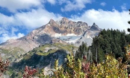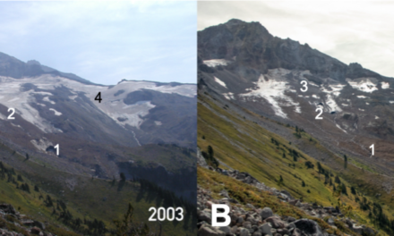
Back in the spring I wrote on Facebook about a long, hot day on the Lamberson Spur Trail on the east side of Mount Hood. What stuck with me was how dry it was: no snow at all, and the whole area felt like a tinderbox. I came away with what I called a sobering reminder of how easily a lightning strike becomes a forest fire.
On the night of July 23, that’s exactly what happened, not far to the south-east.
Over the next ten weeks the Grasshopper Fire grew to roughly 94,000 acres, destroyed a historic lookout and dozens of structures, burned through most of the Badger Creek Wilderness, put a ski area under a “Go Now” evacuation order, and closed a big piece of the forest that many of us think of as our backyard. This is an attempt to pull the whole story together in one place: how it grew, what it did to hiking and to the communities around it, and what comes next.
At a glance
- Started: late on July 23, 2026, by lightning (InciWeb)
- Location: east side of the Mt. Hood National Forest, about 14 miles southwest of Dufur, in Hood River and Wasco counties
- Size: 93,971 acres; 98% contained as of September 30, with full containment expected on October 1 (InciWeb)
- Structures destroyed: 33, most of them in a single afternoon run near Friend on August 10 (Columbia Gorge News)
- Lost landmark: Flag Point Lookout (USFS)
- Firefighters: close to 1,900 at the peak in mid-August (Columbia Community Connection)
- Containment line: more than 330 miles built or reinforced
- Closure: a reduced forest closure stays in place until December 31 unless lifted sooner (USFS closure order)
How the fire grew
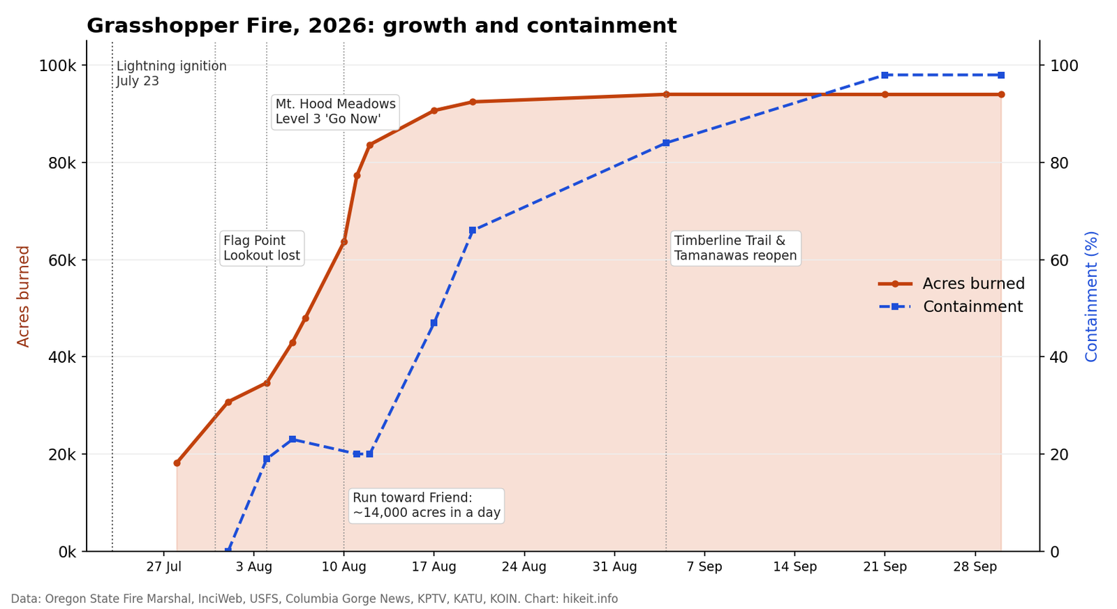
Acreage and containment through the life of the fire. Chart: hikeit.info, from Oregon State Fire Marshal, InciWeb, USFS and local news figures.
Late July: into the wilderness
The fire was reported at 7:41pm on July 23, about three and a half miles west of Rock Creek Reservoir. For a day it looked containable: scooper planes and a heavy helicopter dipped water from Timothy Lake, air tankers dropped retardant, and by Friday evening it was estimated at about 100 acres. On Saturday afternoon, wind shut down the aircraft, and in dry fuels the fire began spotting and crowning, running all the way to Badger Creek (USFS).
From there it pushed in two directions at once: deeper into the wilderness, and south and east towards the small communities strung along the forest edge. By July 28 it had reached about 18,000 acres, and Pine Hollow, Wamic and Sportsman’s Park were under Level 3 “Go Now” orders, with Tygh Valley at Level 2 (Columbia Gorge News).
Overnight on July 31 the fire reached Flag Point. Crews had spent three days preparing the lookout, clearing vegetation, removing trees and laying retardant around it, but fire behaviour and smoke eventually made it too dangerous to stay. The lookout burned. There had been one on that butte since 1924, and the Forest Service said it “holds a special place for many members of the surrounding communities” (USFS).
By the following day the fire had passed 30,000 acres with no containment at all, and when it crossed Forest Road 27, structural task forces from The Dalles were sent in to protect the community of Friend (Oregon State Fire Marshal).
Early August: the turn towards the mountain
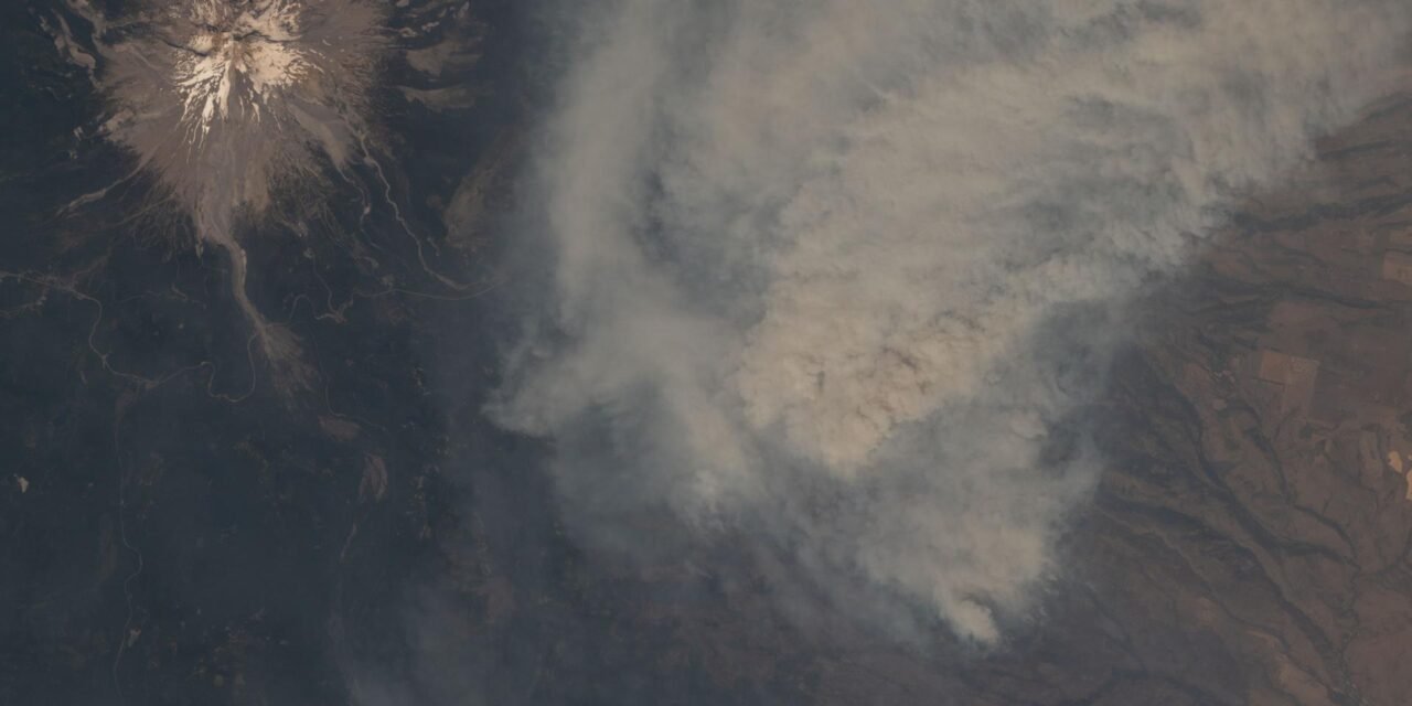
Then the wind swung round. East winds pushed the fire west into Hood River County and towards Highway 35. On August 4, Hood River County issued Level 3 orders for a wide area east of the highway, including Mt. Hood Meadows, Bennett Pass, Lookout Mountain, Gunsight Butte, Elk Mountain and Tamanawas Falls, while Clackamas County put Rhododendron and Government Camp on Level 1 “Be Ready”. The same day, the Portland metro area briefly ranked among the five worst places in the world for air quality (KPTV).
For those of us who treat the Highway 26 and 35 corridor as our weekend playground, this was the moment the fire stopped being something happening “out east”.
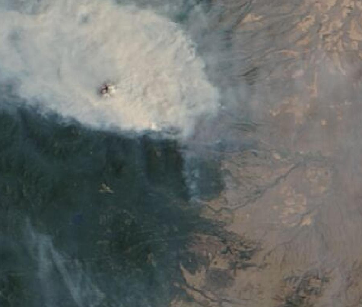
Smoke over the Hood corridor on August 4, the day Mt. Hood Meadows was ordered to evacuate. Image: NASA Worldview (MODIS Terra).
A crew leader on the fire summed up the anxiety that week simply: “I always worry about the weather” (OPB).
The weather, for once, cooperated. Westerly winds returned within days, crews went on the offensive, and Skibowl and Timberline reopened for summer activities, although by then the fire had passed 43,000 acres (KPTV). The fire was held east of Highway 35, though the highway itself closed intermittently.
August 10: the run on Friend
The fire’s worst day came when the wind turned it east again. On Monday, August 10, it grew by nearly 14,000 acres, the most active 24 hours of the whole incident. Officials watched it cover three to four miles in an hour as its northeast corner threw embers through dry grass above Friend Road, before firefighters finally stopped it at Hix Road. Six homes and 15 outbuildings were lost that afternoon (Columbia Gorge News).
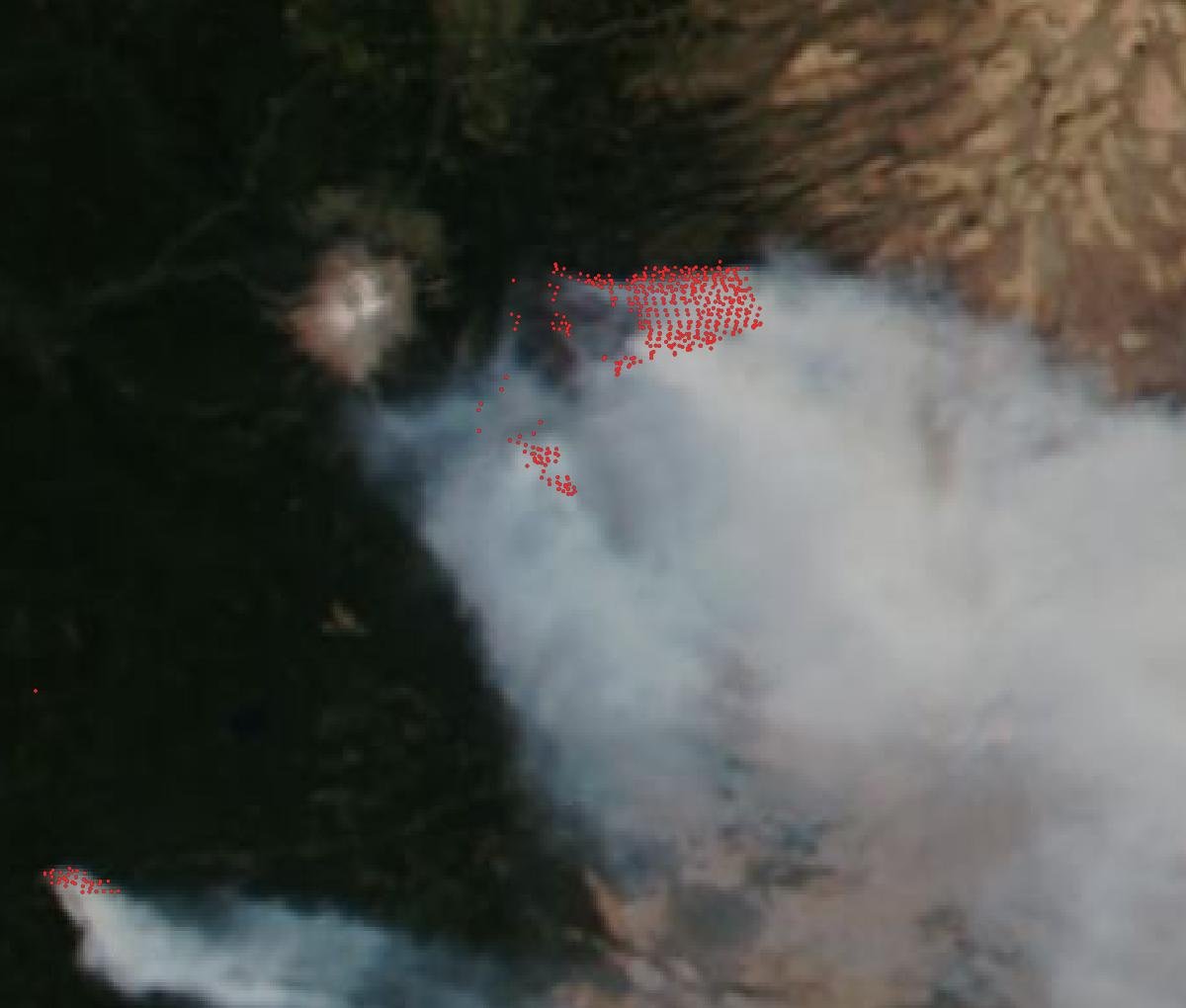
Heat detections (red) on August 10, the fire’s most active day. Image: NASA Worldview (VIIRS NOAA-20 with thermal anomalies).
By the next day the fire had reached more than 77,000 acres, and containment actually went backwards, from 23% to 20% (KATU).
Mid-August to October: the long tail
That run was the fire’s last big push. Within ten days containment had jumped from 20% to 66% as nearly 1,900 firefighters worked the lines (Columbia Community Connection). Rain and cooler weather in early September calmed it further, and by the end of the month the only uncontained stretch was a mile of line in the steep Boulder Creek drainage below Badger Butte, where hazard trees and poor access slowed the final tie-in (Columbia Gorge News). The last evacuation notices in Wasco County were lifted on September 29 (InciWeb).
What it means for hiking
What burned
The burn scar now covers most of the Badger Creek Wilderness, the quiet, drier country of ridges, meadows and creek canyons between Mount Hood and the high desert. The good news, if there is any, is that it didn’t burn evenly. Fire officials describe a mosaic: some areas burned hard, others lightly or not at all. A Burned Area Emergency Response team is assessing the damage (Columbia Gorge News).
Beyond Flag Point, preliminary assessments found damage at Bonney Horse Camp, Bonney Crossing, Little Badger, Fifteenmile and Badger Lake campgrounds. Pebble Ford, Eightmile, Lower Eightmile and Underhill campgrounds and Camp Baldwin were saved.
One hiker who knew the area well put it plainly on his blog after the lookout burned: “my heart is broken, yet again” (Off the Beaten Trail).
What’s still closed
The forest closure was updated on October 1 and stays in effect until December 31 unless lifted earlier. It covers a large block east of Highway 35, roughly between Forest Road 44 to the north and Forest Road 48 to the south. Among the trails still closed (USFS closure order):
- Badger Creek Wilderness: Badger Creek #479, Gumjuwac #480, Divide #458, Little Badger #469, Post Camp #467, Bonney Meadows #471
- Lakes and lookouts: Boulder Lake #463 and Boulder Lakeshore #463B, Little Boulder #463A, Jean Lake #680, Lookout Mountain #450, Gunsight Butte #685
- Further east: Fifteenmile #456, Cedar Creek #457, Tygh Creek #460, Rocky Butte #475, Knebal Springs #474, Underhill #683
Closed sites include the Badger Creek, Boulder Lake, Fret Creek, High Prairie and School Canyon trailheads, Badger Lake and Bonney Meadows campgrounds, and the Billy Bob and Pocket Creek sno-parks, which will matter to snowshoers this winter. Fivemile Butte Lookout is closed too.
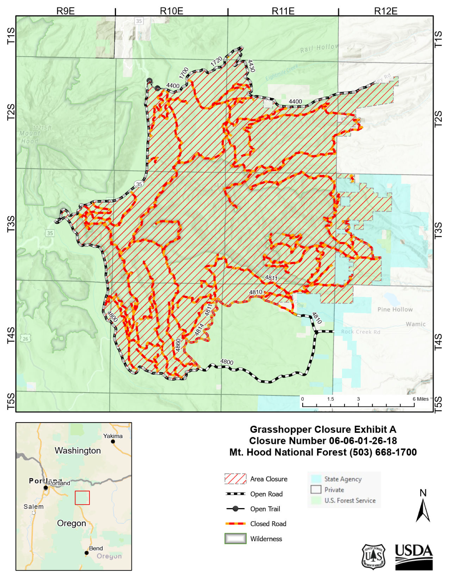
The closure area as of October 1. Map: USDA Forest Service, Mt. Hood National Forest.
What’s open again
The headline reopenings came on September 4, just in time for Labor Day: the Timberline Trail, Tamanawas Falls Trail, and Rock Creek Campground and Day Use Area, plus Timothy Lake, which PGE had closed because of separate fires further west (USFS news release). Zigzag Trail #678 and Surveyor’s Ridge Trail #688, which form part of the closure boundary, are also open.
So the classic east-side loop, Tamanawas Falls (now from the Polallie Trailhead), and the Timberline Trail circuit are all hikeable. If you’re heading out, expect fire traffic on Forest Road 44, check the closure map before you go, and remember that a full campfire ban was still in effect across the forest at the start of September.
The resorts
Mt. Hood Meadows spent nearly two weeks under a Level 3 order. It ended its summer season early, describing the fire as “still an active and challenging wildfire”, and turned its car parks into a camp for more than 300 firefighters (SAM Magazine). It was still serving as the fire’s main camp over Labor Day.
The community cost
For the people who live along the forest’s eastern edge, this was far more than a closed trail. Pine Hollow, Wamic, Sportsman’s Park, Tygh Valley, Friend and parts of Hood River County spent weeks under evacuation orders. Six family homes were lost near Friend, and 33 structures in total. The Wasco County Fair was cancelled (OPB).
The economic hit reached well beyond the fire line. With Highway 35 closed and the air thick with smoke, a Hood River cidery owner described a road gone silent: “Nobody’s coming down the mountain, nobody’s going up” (KPTV).
All of this happened in a year when, by acreage burned, Oregon recorded its most severe fire season on record (OPB). Federal funds will cover up to 75% of the Grasshopper Fire’s suppression costs (Columbia Gorge News).
What comes next
Containment isn’t the end. Crews are now on suppression repair: rehabilitating dozer and hand lines, chipping debris, and hauling hazard trees out along the roads. As one fire spokesperson put it, “The work doesn’t just stop once fire isn’t on the ground anymore” (Columbia Gorge News). The repair work matters for hikers too, because unrepaired fire lines are erosion waiting to happen, and erosion is what turns a burned trail into a lost one.
Then comes the slow part. This spring I hiked to Elk Cove along the edge of the 2011 Dollar Lake Fire, a fully burnt ridge of snags stretching as far as you can see, and I counted 99 blowdowns between the trailhead and the Timberline Trail. Fifteen years on, that’s what a burn scar on Hood looks like: striking, exposed, and a lot of work for the trail crews. Badger Creek will go through the same cycle. Expect hazard trees, washouts and blowdowns for years, and expect trails to reopen in stages rather than all at once.
That’s where TrailKeepers of Oregon and the Forest Service trail crews come in. If you’ve ever enjoyed the east side of the mountain, this is a good year to volunteer or donate.
Further reading and sources
- InciWeb: Grasshopper Fire
- Mt. Hood National Forest: Grasshopper Fire closure order and map
- USFS: Wind and heat create very active fire day
- USFS: Grasshopper Fire consumes Flag Point Lookout
- Oregon State Fire Marshal: Crews defend community of Friend
- Columbia Gorge News: Grasshopper burns homes, fair relocated
- Columbia Gorge News: Nearly contained, suppression repair continues
- OPB: 6 houses burned, 200 buildings threatened
- KPTV: Grasshopper Fire closes highway, hurts Hood River businesses
- SAM Magazine: Mt. Hood Meadows ends summer operations
- hikeit.info: Wildfire Resource Page
Images: NASA/Jack Hathaway (ISS photo); NASA Worldview (satellite imagery); USDA Forest Service (closure map); chart by hikeit.info.