

As the warm weather continued into July I thought it was a good opportunity to try the Zigzag Mountain Trail loop again. Well, it’s not so much a loop more like a rather big “C” and the end of the “C” is a 5-mile road hike. Even so, with the bettering weather, it was a good opportunity to try this trail again. This would be the fourth or fifth time I’ve attempted this hike each of the previous attempts has been thwarted by snow. The last attempt was back at the end of May when the snow started to appear at about 4500 feet. The second week in July seems very late to be able to complete a hike at such a low elevation. However, I was hopeful that I’ll be successful in this attempt.
Setting off on the trail again
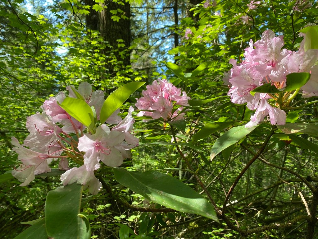
Hunter and I set off early in the morning starting at the Zigzag Mountain trailhead. I’m pretty used to the first 4 miles of the trail. An initial group of nine switchbacks takes you quickly up the slope of Zigzag Mountain rising around 2000 feet. In the lower elevations, the rhododendrons were blooming well, maybe a little bit past their prime. However, as we rose up the ridge of Zigzag Mountain the blooms look younger and fresher. Often the blooms would form an arch across the trail, giving it a procession-like feel. Many other types of flora graced the trail.


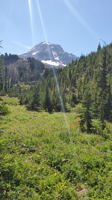
After about 4 miles and just before West Zigzag Mountain, the view starts to open up below. You can see the small town of Rhododendron, sandwiched between the ridges on either side. Even though Mt. Hood is still hidden, there are sweeping views towards Sandy and teasing views of the valley east. A good majority of the trail is through pines, with either no or filtered views of the surrounding vistas. As the trail loops its way around the backside of West Zigzag Mountain, suddenly the pristine view of Mount Hood appears.
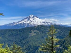
For all the hard climb and vertical gain, it’s a view that is certainly worth every step. This is a unique point from which to take in the entirety of Mt. Hood. Further away than if you were on the timberline Trail, but still close enough to be able to recognize all the facets of the mountain. This is by far the best view of Mt. Hood from this trail, so savor the time here.
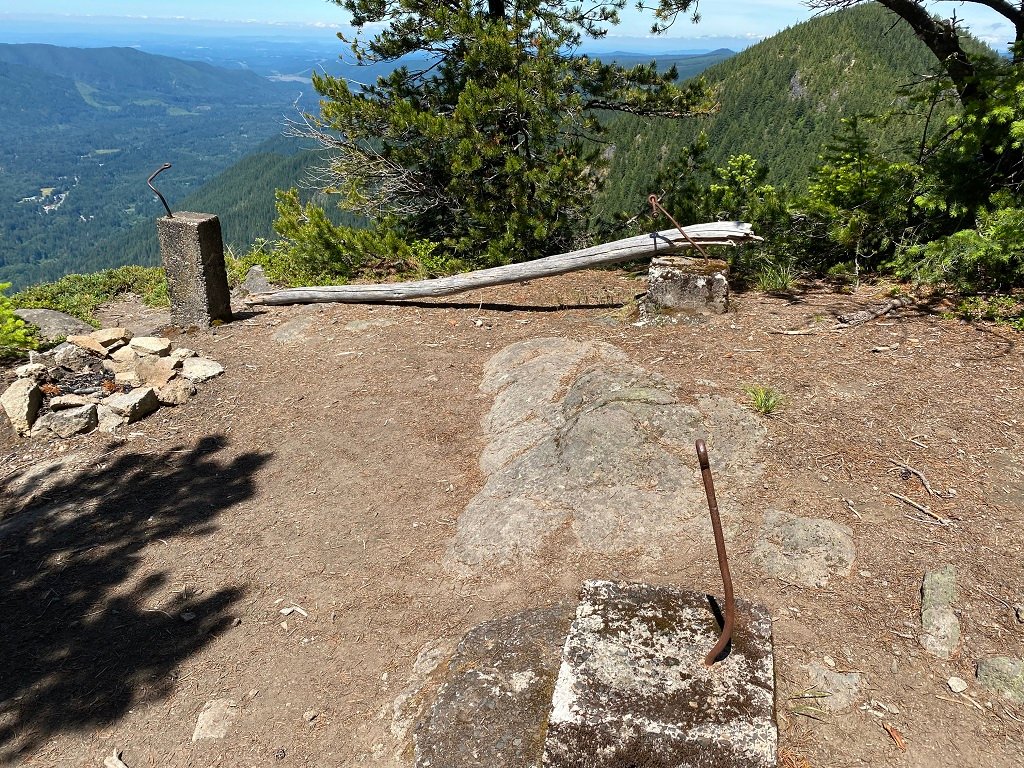
As the trail completes its way around West Zigzag Mountain you pass some rock outcrops. Some of these are the cliff face dropping hundreds of feet below and opening up wide views towards Portland. Just a little bit further on are the remains of the old fire tower lookout. All that remains now are the foundation pillars for what was once a great spot for looking for forest fires. Shortly after this, the trail starts to descend weaving its way through rhododendron bushes again on the way towards the West Zigzag trail. You are again dropped into the enclosed pine forests, lacking some of the previous sweeping views.
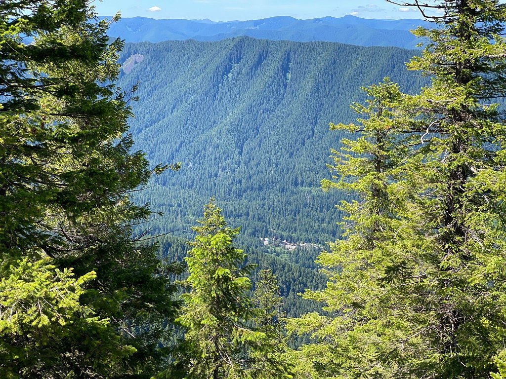
The West Zigzag Trail descends quickly towards the trailhead, occasionally crossing a couple of streams. The most notable of these is Henry Creek, which you cross just before reaching the trailhead and is almost at its headwaters. Henry Creek provides the drinking water for much of Rhododendron.

We arrived at a rather empty trailhead at the top of Forest Road 27. Forest Road 27 is one of the more unmaintained forest service roads and so it’s not uncommon that few vehicles make it this far. Unfortunately, it’s a reasonable walk back down to Highway 26. A good deal of this is pleasant, again surrounded by trees.
However, in the middle, there is a section of clear-cut showing the stark contrast between the forest and the bare land. Eventually, we got to the end of the rough road, and followed the rest of the way to Highway 26, passing Forest service cabins on the left-hand side. At the highway, we crossed over and followed the Pioneer Trail back to the town of Rhododendron.
Although the trail itself is only about 8 1/2 miles, the walk down Forest Road 27 is another 3 miles and the final hike back down to Rhododendron is another 2 miles. So in total that made for about a 13-mile hike. It would certainly be easier if you could arrange a shuttle or have someone meet you at the trailhead!
Now that the hiking season is in full swing – check out my other hikes.


