

Sometimes you only have time for a short hike. That was the case this weekend when I thought I’d try out Castle Canyon Trail (#765) on Mount Hood, which makes its way up one side of ZigZag mountain. This is advertised as a short and steep trail, with the last half being the steepest, but with some rewarding results – in several pinnacle rock formations. Beautiful fall days are perfect for hiking and Saturday was definitely one of these; clear skies and pleasant temperatures. So Hunter and I set out for this short hike.
Getting to the trail head

The trailhead is definitely a little obscure. It’s at the end of Forest Service Road 19, which is also called ZigZag River Road, which is also East Henry Creek Road – no confusion there. If you are traveling from Portland, take Highway 26 to Rhododendron and then turn left immediately before Mt. Hood Foods onto East Arlie Mitchell Road. After about 1/3 of a mile turn left again at the corner onto the Forest Service Road (also marked as the Barlow Trail). Follow this road to the end – about a mile. There is not a lot of parking, just the occasional pullout on a single-lane road. The trailhead is hard to miss thou.
Just as a note – as this was the 16th of October, there is no need to fill out a wilderness permit. At least in Mount Hood National Forest wilderness permits are only required from May 15th to October 15th.
With that, Hunter and I set off.
The first third – nice and gentle
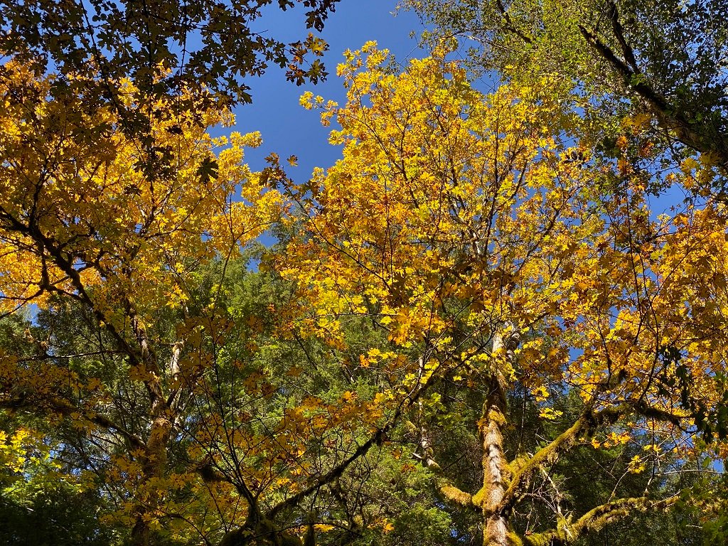
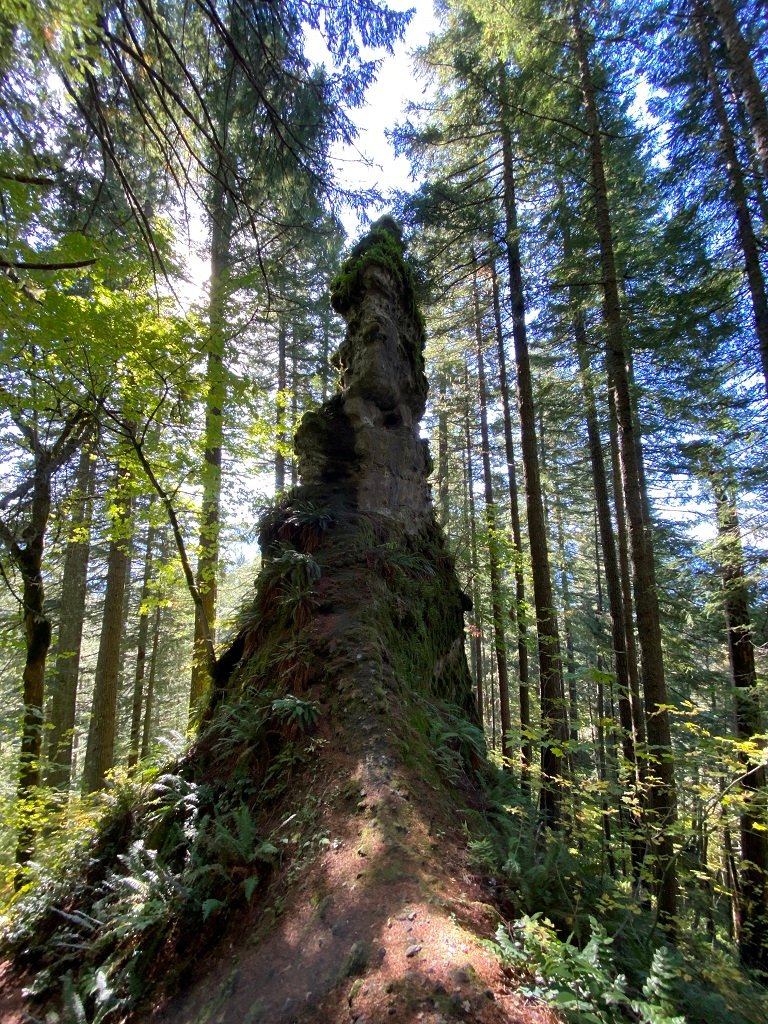
The trail starts off as a gentle, slightly ascending trail. Perfect for enjoying the fall colors and the beauty of the forest. The intermingling of pines and deciduous trees brings the fall colors into sharp contrast, with the clear blue sky as a backdrop. Nurse logs lying across the forest floor, slowing decomposing and providing a rich ecosystem. Mushrooms of all varieties growing from the ends. Mosses hanging off the tree limbs, dripping with the morning dew, still not yet burnt off by the weaker autumn sun.
Slowly the path starts to ascend a little steeper and then begins a series of switchbacks, not yet steep but the vertical climb starts to get your heart pumping.
Given this is a little out-of-the-way trail I expected it to be quiet but was pleasantly surprised to meet at least a dozen other hikers out for a morning stroll.
The remainder of the trail – up and away!
Now the trail rapidly gets steeper and in places requires a little bit of scrambling. No problem for a dog with four paws. In places, the trail starts to narrow. Then you see the first of several rocky outcrops. Amazingly narrows pinnacles spiraling upwards. Some larger and some smaller. Many of these have goat trails that let you scramble to the top – but be warned there are steep drop-offs on either side. At times it feels like you are walking on a narrow knife edge.

First Pinnacle – spire Knife Edge Ridge Second Pinnacle Scramble up a pinnacle
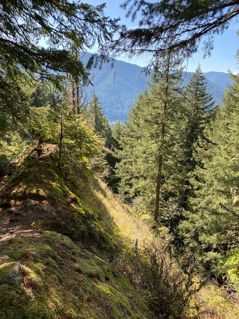


There are several side trails off of the main trail. Some of these lead to other pinnacles and equally spectacular views. The trail gets yet steeper the higher you go. There are places where you have to scramble up rocks, but eventually, the trail just peters out. A good place for a rest before turning around and descending back.
A short hike – with a round trip of just about two miles, but without 1’000 feet of elevation gain, is a real workout!
Looking for more great hikes on Mt. Hood?
Summary
- Short and steep there and back on the southwest side of Mount Hood (ZigZag Mountain)
- Pinnacle rock formations looks like the towers of a castle!
- Ascend almost 1’000 feet, most in about 1/2 mile.
- Limited parking, no trailhead facilities.


