
As I move along my preparation for my JMT hike this year (see here and here), I’ve learned a huge amount from the JMT Facebook page. However, there are always a few questions that seem to reoccur. I’m not going to cover topics that are really well covered on the Facebook page, such as permits. But there are a couple of topics that are worth deeper discussions for your JMT hike: bear boxes, rivers, and snow.
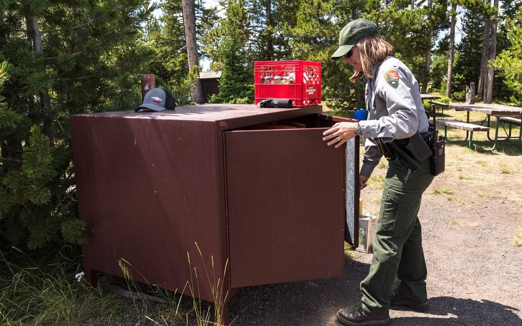
Bear Boxes and storing food
There’s always a lot of discussion about bear canisters and how much food you can get in one. This is particularly of concern in the southern section of the JMT where there is no convenient trail resupply between MTR and Whitney Portal. NOBO hikers are concerned they are starting with a full load of food, and don’t yet have their hiking legs. This always begs the question – can I make it from the southern end (Cottonwood or Whitney) to MTR without having to resupply off-trail?
Luckily there is another answer to putting all your food in your bear canister – that’s bear boxes. There are several well-placed bear boxes, particularly on the southern end of the trail. (There are several bear boxes throughout the JMT but it’s the southern ones that are particularly useful. These bear boxes allow you to take more food than will fit into your bear canister and store it in the bear boxes for the first night or so. This giving you a little more breathing room for your NOBO journey.
Here is a map of all the bear boxes in the Sierra.
This map contains updated information on bear boxes, details on locations and conditions, and is often updated. I took the details of bear box locations on the JMT and mapped them onto a Google map. I find this is a little easier to navigate.
What will the snow be on the 25th of June?
As start dates begin to loom, one of the most common questions is about snow. This is particularly common for the folks with June or early July start dates. In the months of February and March, it is common to ask what the snow will be like in three months. Of course, there is no way to answer this. Even in a low snow year, there can be late-season snowstorms. You need to be prepared for whatever the conditions are. This may mean changing your gear/plan or even canceling your trip if you are not comfortable with the conditions.
There are some resources you can use to understand the snow conditions closer to your start date.
Postholer has useful maps of the snow depth and how it is tracking against previous years.
Sentinel has satellite maps that are updated every three days. These are useful ways to visualize the conditions. You can also compare this with previous years.
You should also check out blogs and vblogs from PCT hikers. These folks are generally ahead of the JMT hikers, with the date to enter the Sierra on a typical year (Ray Jardine Day) in the middle of June. However, there are many that will enter before that. These reports will be invaluable in knowing current conditions.
Rivers and Snow
The challenges of an early entry into the Sierra are crossing river and snow travel. If you enter during the snow thaw then river crossings can be dangerous. Traveling on snow requires different navigation skills and an understanding of snow conditions. To get an understanding of the necessary techniques, check out Ned Tibbits Facebook page. Ned has super helpful information on when to enter the Sierra, how to cross streams, snow travel, and much more. He is a wealth of information and very approachable. If you have an opportunity to take one of his snow classes – you’ll get real experience before hitting the trail.
Hopefully, this helps you plan for your JMT hike with bear boxes, snow, and river information.


